Geodesy
Geodesy tools and items
Luanti mod geodesy
A mod that adds surveying tools for measuring distances in your world.
How to use (player guide)
What you need
This mod adds two items for measuring distances:
- Levelling Staff (measuring rod) - a tall striped pole you place at the target location
- Theodolite (viewing instrument) - a tool you use to look at the staff and measure distance
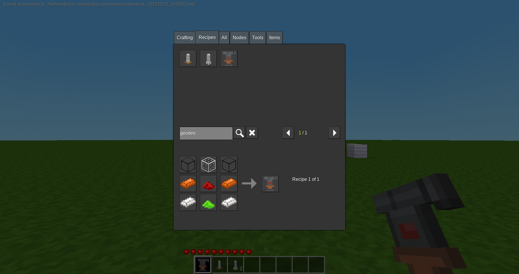
Craft these items using the recipes defined in the mod (check your crafting guide).
Quick start guide
Basic measurement in 3 simple steps:
-
Place the staff at your target
- Take the levelling staff and place it at the location you want to measure to
- The staff consists of two parts: place the bottom part first, then right-click it with the top part to complete the staff
- You should see a tall pole with colored stripes (ticks)
-
Stand at your starting point and use the theodolite
- Go to the location you want to measure from
- Hold the theodolite and right-click (place/use button) to activate zoom mode
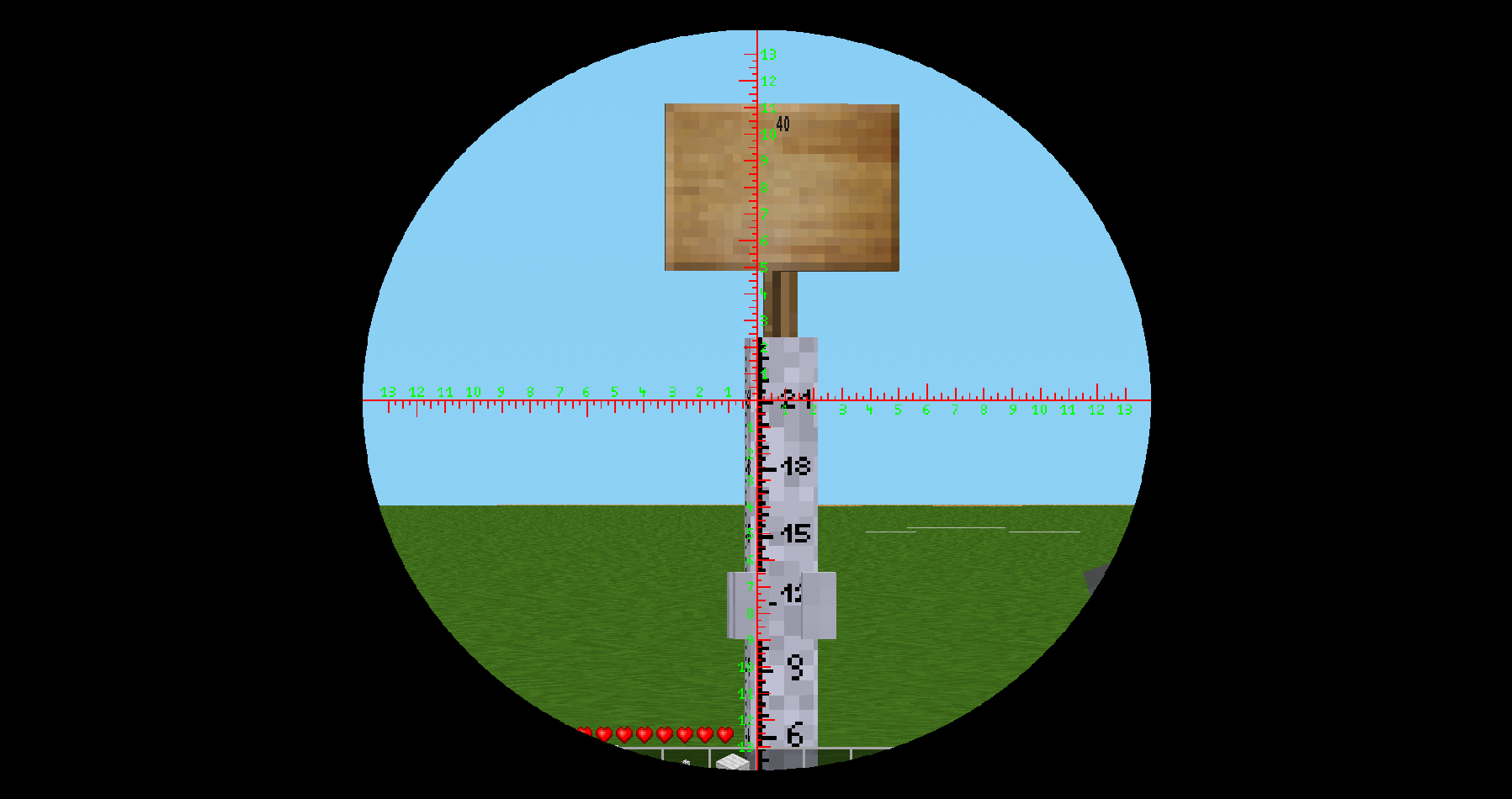
- You'll see a magnified view with crosshairs on the screen
- Look at the staff you placed earlier
-
Count the colored stripes (ticks)
- Count how many colored stripes on the staff are visible between the crosshair lines
- More ticks = farther distance
- Fewer ticks = closer distance
- Right-click again to exit zoom mode
Understanding the measurements
The theodolite works on a simple principle: objects appear smaller when they're farther away.
- If you count 6 ticks at a distance you know is 20 blocks, and later count 12 ticks, the new distance is 40 blocks (double the ticks = double the distance)
- If you count 6 ticks at 20 blocks, and later count 3 ticks, the new distance is 10 blocks (half the ticks = half the distance)
Formula for calculating distance:
distance = known_distance × (ticks_now / ticks_at_known_distance)Calibration (optional but recommended)
For more accurate measurements, calibrate first:
- Place a staff at a known distance (for example, count 20 blocks from where you're standing)
- Use the theodolite and count the ticks - let's say you see 6 ticks
- Now you have your reference: 6 ticks = 20 blocks
- For any future measurement, use:
distance = 20 × (new_ticks / 6)
Example: If you later see 9 ticks, the distance is: 20 × (9 / 6) = 30 blocks
Tips for best results
- Stand at the same height as the staff for consistent measurements
- Use flat ground when possible - hills can affect accuracy
- Use round numbers for your reference distance (10, 20, 50 blocks) - makes math easier
- Place the staff precisely on the target block
- The measurement works the same regardless of your screen resolution
Test environment command
To quickly create a set of test stations use the chat command:
/geodesy_create_test_place <count> <distance>- Example:
/geodesy_create_test_place 4 20will create 4 stations at 20, 40, 60 and 80 nodes from your current position in the direction you are looking. - Privilege: requires the
creativeprivilege. - The command checks for the
signs_libmod and will abort with an error if it is not enabled. - The node under your current position will be changed to a gold block and each test station consists of the down and up staff nodes plus a sign showing the distance.
Recommendation: run the command on a flat map (use a flat map generator) to avoid terrain interfering with the test stations.
Found bug? Want improvements?
If you foun bug, have improvment idea etc, use https://github.com/sfence/geodesy/issues . Author is opened to help via PR, but strongly recommend to consult improvment idea first via issue or different comunication platform.
Links
- Source: https://github.com/sfence/geodesy
- Forum: https://forum.luanti.org/viewtopic.php?t=32052
- Issues: https://github.com/sfence/geodesy/issues
- Original ContentDB page: content.luanti.org/packages/SFENCE/geodesy/
License
MIT
Media license: CC-BY-SA-4.0
Development state
BETA
| Version | Date | Min engine | Size | Download |
|---|---|---|---|---|
| 0.9.0 | 2025-10-13 15:19:22 | 30.7 KB | Download |